Blog

Archive for the ‘dengue’ tag

Dec 20, 2020

Filipino startup recognized in addressing SDG’s using space tech

Posted by in categories: health, space
2020 GEO SDG Award for CirroLytix

MANILA, Philippines — A Filipino startup is recognized globally in developing a dengue hotspot prediction system using satellite and climate data in the 2020 Group on Earth Observations Sustainable Development Goals (GEO SDG) Awards for the Sectoral category, For-Profit. The GEO SDG Awards recognize the productivity, ingenuity, proficiency, novelty, and exemplary communications of results and experiences in the use of Earth observations to support sustainable development.

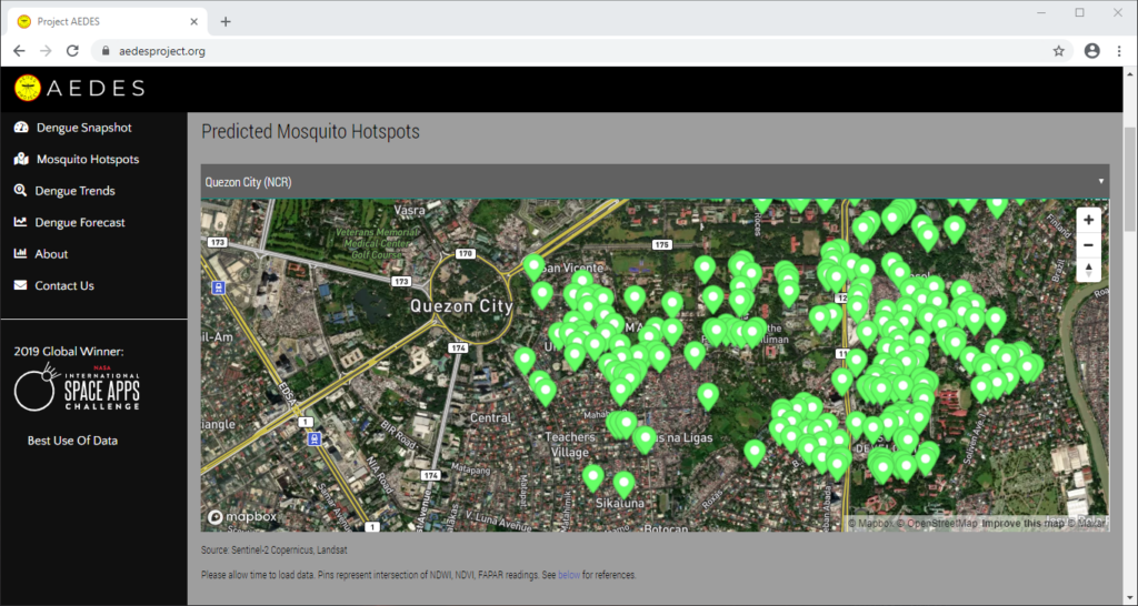
CirroLytix Research Services was formed to create social impact through big data. Through the application of machine learning, data engineering, remote sensing, and social listening, the Philippines-based data analytics firm hopes to help governments, researchers, non-government organizations (NGO), and social enterprises achieve positive change. The Advanced Early Dengue Prediction and Exploration Service (Project AEDES) is one of the CirroLytix’s flagship projects developed during the 2019 National Aeronautics and Space Administration’s (NASA) International Space Apps Challenge. It combines digital, climate, and remote sensing to nowcast dengue trends and detect mosquito habitats to help pre-empt cases of dengue. Project AEDES process leverages normalized difference vegetation index (NDVI), Fraction of absorbed photosynthetically active radiation (FAPAR), and normalized difference water index (NDWI) readings from Landsat and Sentinel-2 to estimate still water areas on the ground, which is correlated with dengue case counts from national health centers.
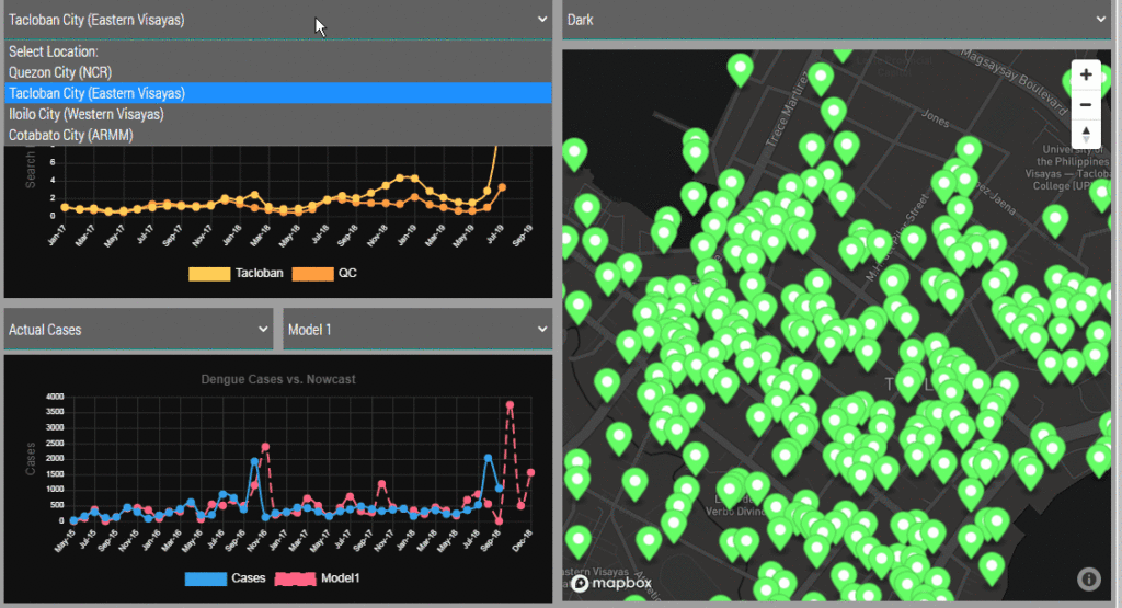
The Advanced Early Dengue Prediction and Exploration Service (Project AEDES) combines digital, climate, and remote sensing to nowcast dengue trends and detect mosquito habitats to help pre-empt cases of dengue.

Dominic Vincent “Doc” Ligot, co-founder and chief technology officer of CirroLytix, describes Project AEDES as an “early detection of panics from online searches, anticipating case counts from environment readings, but most importantly pinpointing hotspots from mosquito habitat detection.”
The Pinoy-made dengue mapper tool won the annual international hackathon of NASA globally in the best use of data, the solution that best makes space data accessible, or leverages it to a unique application. Aside from winning last year, CirroLytix also developed an integrated public policy information portal measuring the impact of the coronavirus pandemic using Earth observation, in-country economic and human mobility data, and global infection case counts, thus winning again in the Space Apps COVID-19 Challenge for the same category in the best use of data. Named G.I.D.E.O.N. (Global Impact Detection from Emitted Light, Onset of COVID-19, and Nitrogen Dioxide), this dashboard for policy makers and economic planners shows the impact of COVID-19 on various countries and effects on the economy and environment.

Continue reading “Filipino startup recognized in addressing SDG's using space tech” »

Apr 22, 2020

Dengue case predictor mapping system wins the 2019 NASA global hackathon

Posted by in categories: astronomy, big data, computing, disruptive technology, environmental, events, hacking, information science, innovation, machine learning, mapping, open source, satellites, science, software, space
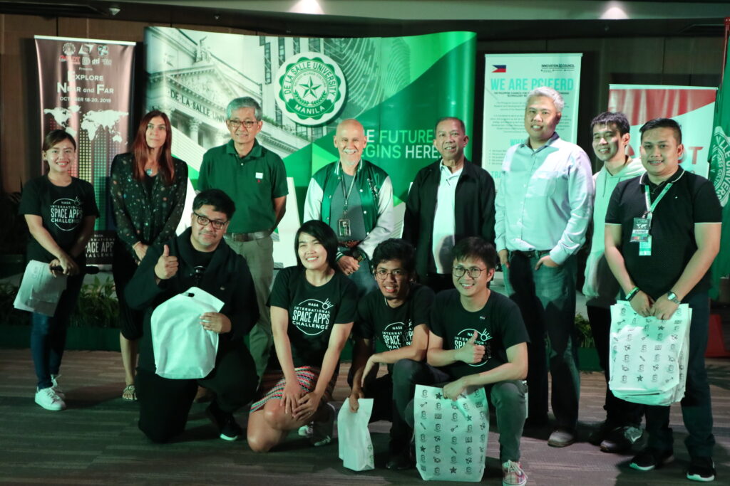
Upper row Associate American Corner librarian Donna Lyn G. Labangon, Space Apps global leader Dr. Paula S. Bontempi, former DICT Usec. Monchito B. Ibrahim, Animo Labs executive director Mr. Federico C. Gonzalez, DOST-PCIEERD deputy executive director Engr. Raul C. Sabularse, PLDT Enterprise Core Business Solutions vice president and head Joseph Ian G. Gendrano, lead organizer Michael Lance M. Domagas, and Animo Labs program manager Junnell E. Guia. Lower row Dominic Vincent D. Ligot, Frances Claire Tayco, Mark Toledo, and Jansen Dumaliang Lopez of Aedes project.

MANILA, Philippines — A dengue case forecasting system using space data made by Philippine developers won the 2019 National Aeronautics and Space Administration’s International Space Apps Challenge. Over 29,000 participating globally in 71 countries, this solution made it as one of the six winners in the best use of data, the solution that best makes space data accessible, or leverages it to a unique application.

Dengue fever is a viral, infectious tropical disease spread primarily by Aedes aegypti female mosquitoes. With 271,480 cases resulting in 1,107 deaths reported from January 1 to August 31, 2019 by the World Health Organization, Dominic Vincent D. Ligot, Mark Toledo, Frances Claire Tayco, and Jansen Dumaliang Lopez from CirroLytix developed a forecasting model of dengue cases using climate and digital data, and pinpointing possible hotspots from satellite data.

Sentinel-2 Copernicus and Landsat 8 satellite data used to reveal potential dengue hotspots.

Correlating information from Sentinel-2 Copernicus and Landsat 8 satellites, climate data from the Philippine Atmospheric, Geophysical and Astronomical Services Administration of the Department of Science and Technology (DOST-PAGASA) and trends from Google search engines, potential dengue hotspots will be shown in a web interface.

Using satellite spectral bands like green, red, and near-infrared (NIR), indices like Fraction of Absorbed Photosynthetically Active Radiation (FAPAR) and Normalized Difference Vegetation Index (NDVI) are calculated in identifying areas with green vegetation while Normalized Difference Water Index (NDWI) identifies areas with water. Combining these indices reveal potential areas of stagnant water capable of being breeding grounds for mosquitoes, extracted as coordinates through a free and open-source cross-platform desktop geographic information system QGIS.

Check out the website here: http://aedesproject.org/

Winners visit the Philippine Earth Data Resource and Observation (PEDRO) Center at the DOST-Advanced Science and Technology Institute in Diliman, Quezon City with Dr. Joel Joseph S. Marciano, Jr.