Blog

Archive for the ‘satellites’ category: Page 95

Jul 15, 2021

SpaceX: How Mars “spy satellite” creator tracked Elon Musk’s Tesla Roadster

Posted by in categories: Elon Musk, satellites, sustainability

An engineer who helped develop a camera for Mars has built a tool to track the most fascinating car in the Solar System.

Jul 14, 2021

Amazon acquires Facebook’s satellite internet team, bolstering its efforts to compete with SpaceX

Posted by in categories: internet, physics, satellites

Amazon acquires Facebook’s Satellite Internet team!

Project Kuiper going strong to compete SpaceX’s StarLink, OneWeb and Telesat.


The deal bolsters Amazon’s $10 billion effort to develop low Earth orbit (LEO) satellites capable of delivering high-speed broadband internet around the globe, while marking the end of Facebook’s ultimately unsuccessful efforts to do the same.

Continue reading “Amazon acquires Facebook’s satellite internet team, bolstering its efforts to compete with SpaceX” »

Jul 11, 2021

Observing satellite startup Planet is going public

Posted by in category: satellites

The deal values the San Francisco-based company at $2.8 billion.


Planet, which operates the world’s largest fleet of Earth-observing satellites, announced Wednesday (July 7) that it will merge with a special purpose acquisition company.

Jul 11, 2021

Massive solar storm heading towards Earth can impact GPS, mobile signal. Details here

Posted by in categories: mobile phones, satellites

According to NASA, the solar storm is travelling towards Earth at a velocity of 1.6 million km/hr and the speed might even increase more.

The satellites in the Earth’s upper atmosphere are also expected to get impacted by the incoming flares. This will directly impact GPS navigation, mobile phone signal and satellite TV. The power grids can also be impacted due to the solar flares.

On the positive side, the solar flares will create an amplified view of Aurora lights in North or South Pole. The people living near the poles will get to experience these lights.

Jul 8, 2021

Repurposed communications satellites could help save humanity from an asteroid impact

Posted by in categories: asteroid/comet impacts, existential risks, satellites

What do you do if you discover a big rock on a collision course with Earth and have very little time to take action?


Large telecommunication satellites used for TV broadcasting could be quickly and easily repurposed as anti-asteroid weapons according to European aerospace company Airbus.

Jul 4, 2021

SpaceX Starlink Broadband Internet Service Is Now Available In Denmark

Posted by in categories: Elon Musk, internet, satellites

Featured Image Source: netvault.net.au.

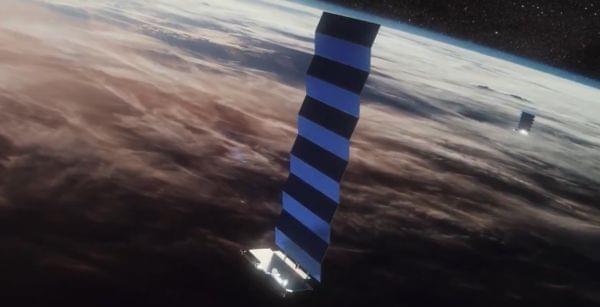
SpaceX founder Elon Musk recently shared that the company is already providing Starlink Beta broadband internet service to over 69420 users globally out of over half-a-million customers who pre-ordered the internet service via Starlink.com. According to SpaceX President Gwynne Shotwell, the Starlink constellation is currently actively beaming its signal to users in 11 countries (now 12), including portions of the United States, Canada, United Kingdom, Germany, Belgium, France, Austria, Netherlands, Australia, and New Zealand. More European countries and regions in the United States will have coverage during the second half of 2021 and early 2022.

This week, SpaceX e-mailed potential customers in the European country of Denmark –“Starlink is now available in limited supply in Denmark!” the e-mail reads. “Users can expect to see data speeds vary from 50Mb/s to 150Mb/s [megabits per second] over the next several months as we enhance the Starlink system. There will also be brief periods of no connectivity at all,” SpaceX wrote in the e-mail. “As we launch more satellites, install more ground stations and improve our networking software, data speed, latency and uptime will improve dramatically.” To date, SpaceX has launched approximately 1740 internet-beaming Starlink satellites out of over 12000 that will be part of the global broadband constellation.

Jun 30, 2021

Virgin Orbit launches 7 satellites on third-ever space mission

Posted by in category: satellites

Virgin Orbit launched seven satellites today (June 30), taking a big step toward regular and reliable commercial launch service.

Jun 29, 2021

Space Development Agency’s first satellites to launch on SpaceX mission

Posted by in categories: military, satellites

The first five payloads from the Space Development Agency, an organization charged with rapidly infusing emerging technologies into the U.S. military’s space programs, are among more than 80 satellites awaiting launch from Cape Canaveral Tuesday on a SpaceX Falcon 9 rocket.

Established in 2019, the Space Development Agency plans to deploy hundreds of small satellites to enable improved communications for the U.S. military. SDA’s strategy leans on the rapid development of new commercial space technology, including new types of sensors and cheaper, easier-to-produce small satellites that can be deployed in large constellations in low Earth orbit.

SDA plans to launch the first tranche of 28 satellites to provide initial infrared missile detection and low-latency data relay services in late 2022 and early 2023. Twenty of those satellites, part of the “transport layer,” will be developed by Lockheed Martin and York Space Systems for communications support. The other eight “tracking” satellites will be supplied by SpaceX and L3Harris for missile detection and tracking.

Jun 29, 2021

Clearest images emerge of galaxies headed for collision on intergalactic ‘highway’

Posted by in categories: cosmology, evolution, satellites

An international group of astronomers has created images with never-before-seen detail of a galaxy cluster with a black hole at its center, traveling at high speed along an intergalactic “road of matter.” The findings also support existing theories of the origins and evolution of the universe.

The concept that roads of thin gas connect clusters of galaxies across the universe has been difficult to prove until recently, because the matter in these ‘roads’ is so sparse it eluded the gaze of even the most sensitive instruments. Following the 2020 discovery of an intergalactic thread of gas at least 50 million light-years long, scientists have now developed images with an unprecedented level of detail of the Northern Clump—a cluster of galaxies found on this thread.

By combining imagery from various sources including CSIRO’s ASKAP radio telescope, SRG/eROSITA, XMM-Newton and Chandra satellites, and DECam , the scientists could make out a large galaxy at the center of the clump, with a black hole at its center.

Jun 27, 2021

Monitoring war destruction from space using machine learning

Posted by in categories: robotics/AI, satellites

Satellite imagery is becoming ubiquitous. Research has demonstrated that artificial intelligence applied to satellite imagery holds promise for automated detection of war-related building destruction. While these results are promising, monitoring in real-world applications requires high precision, especially when destruction is sparse and detecting destroyed buildings is equivalent to looking for a needle in a haystack. We demonstrate that exploiting the persistent nature of building destruction can substantially improve the training of automated destruction monitoring. We also propose an additional machine-learning stage that leverages images of surrounding areas and multiple successive images of the same area, which further improves detection significantly. This will allow real-world applications, and we illustrate this in the context of the Syrian civil war.

Existing data on building destruction in conflict zones rely on eyewitness reports or manual detection, which makes it generally scarce, incomplete, and potentially biased. This lack of reliable data imposes severe limitations for media reporting, humanitarian relief efforts, human-rights monitoring, reconstruction initiatives, and academic studies of violent conflict. This article introduces an automated method of measuring destruction in high-resolution satellite images using deep-learning techniques combined with label augmentation and spatial and temporal smoothing, which exploit the underlying spatial and temporal structure of destruction. As a proof of concept, we apply this method to the Syrian civil war and reconstruct the evolution of damage in major cities across the country. Our approach allows generating destruction data with unprecedented scope, resolution, and frequency—and makes use of the ever-higher frequency at which satellite imagery becomes available.

Page 95 of 189First9293949596979899Last