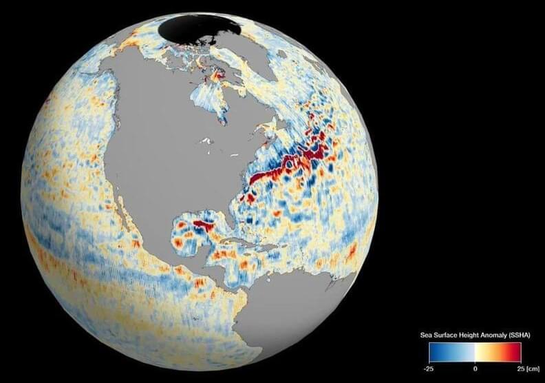
Nov 52023 NASA’s SWOT satellite maps nearly of all Earth’s water (video) Data from the Surface Water and Ocean Topography (SWOT) satellite was used to map surface heights of the planet’s oceans and freshwater lakes and rivers.